PNW Musings: Cape Flattery
You know those nights when you have no reason to be up, but your mind either patiently waits for a reason or eagerly seeks for one? In a manic, nocturnal state, I did what any millennial would–scrolled on any social media apps, pretending the blue light from my phone wouldn’t keep me up.
Eventually, hours had gone and the mindless scrolling lost savor. The wandering thoughts yearned for something more, so I opened Google Maps and began digitally exploring areas on the West Coast, curious about what could and couldn’t be visited. In that quiet hour, I accidentally happened upon Cape Flattery.
Fast forward to early September 2023. I traveled to Cape Flattery, the most Northwest point in the contiguous United States, which is located in the Makah Reservation on the Olympic Peninsula.
The trailhead lowers you toward the Cape into the trees and bushes. Boardwalks take you over small creeks, and the closer you get the more light begins to come through.
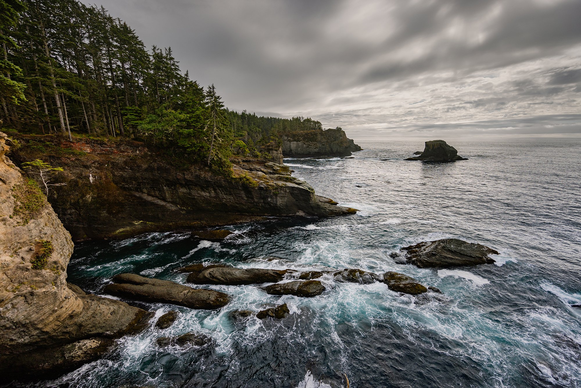
At the end of the Cape Flattery Trail, a panoramic view of Tatoosh Island lies directly ahead. To the southwest, the Pacific Ocean transitions into a bluish jade as it crashes into the steep, rugged cliffs of the Cape. On top of the cliffs are pines of various sizes—some with needles blown off by the wind or the trunk bases hung on the edge bent skyward. To the northeast, Snake Cliff extends far and low into the water. On both sides, water has eroded much of the rock into large caves.
At the end of the Cape Flattery Trail, a panoramic view of Tatoosh Island lies directly ahead. To the southwest, the Pacific Ocean transitions into a bluish jade as it crashes into the steep, rugged cliffs of the Cape. On top of the cliffs are pines of various sizes—some with needles blown off by the wind or the trunk bases hung on the edge bent skyward. To the northeast, Snake Cliff extends far and low into the water. On both sides, water has eroded much of the rock into large caves.
Cape Flattery - Northeast Observation
Snake Cliff extends far and low into the water. On both sides, water has eroded much of the rock into large caves
From the vantage point of the Cape, Makah ancestors spotted early European voyagers who searched for the Northwest Passage and the entry to the Straight of Juan de Fuca, the outlet to the Pacific Ocean between Canada and the US. Makahs are familiar with the waters off the Cape, from seasonal hunting and fishing trips.
Makahs have long been known for hunting seals and whales–whaling being central to their culture. Makah whaling is made spiritual from associated rituals and ceremonies, and whaling events have inspired Tribal songs, dances, designs, and basketry. Whaling is so important to the Tribe, that in 1855 when the Makah ceded thousands of acres of land to the US government, the Tribe was able to reserve their rights to continue whaling within the Treaty of Neah Bay.
The Makah Tribe allows people to visit the reservation. From the official Makah website, is the following phrase in the Makah language “baɫu•ɫ ʔiyax̌aqeysa• Di•ya, ʔuʔɫtʔiq ʔukti•p kʷiči•ye•ʔiq ʔiš waɫa•yuʔu•c Qʷidiččaʔa•tx̌iq — ʔa•ba•qƛ̓iɫtʔiq ƛ̓a•yi•cuxʷadi•,” which translates to “Welcome while you are in Neah Bay, the beginning of the world and the home of the Makah — the Cape People.”
Learn more about the Makah Tribe and Cape Flattery at makah.com.
Visit Neah Bay
Cape Flattery
The trail is 0.75 miles from trailhead to overlook. Please remain on the main trail during your hike. A recreation permit is required.
Dogs are allowed on the trail. Please keep your furry friend(s) on a leash and do not let them leave the boardwalk.
Makah Museum
The Makah Museum at the Makah Cultural and Research Center, “houses and interprets artifacts from the Ozette Archeological Site, a Makah village partly buried by a mudslide 300-500 years ago and discovered in 1970.”
I highly recommend visiting the museum to learn even more about Makahs and their history. Learn more at makahmuseum.com.


